When I first arrived in Waterloo, it took me a while to get a feeling for how cycling works here. Comparing to Germany, the infrastructure for cycling in Waterloo is not per se better or worse, but it works somewhat differently.
The city of Waterloo provides an in-house cycling map. Alternatively, one can turn to the cycle map of openstreetmap. We see bike lanes marked in blue, where different shades indicate different types.
Most streets in this map do not show any sign of blue. In some cases, the information is just missing in the map, but I quickly learned that one should not take this too lightly: There is a decent proportion of streets where there simply is no bike path, and sometimes even no sidewalk, of any sort. Although things are changing quickly, it is still visible that Waterloo (like most north American cities) was built first and foremost for cars. Obviously, one doesn’t try to bike on the highways, but even some of the non-highway streets are much wider, and have more traffic and less pedestrian infrastructure, than one would expect by European measures for a city of this size.
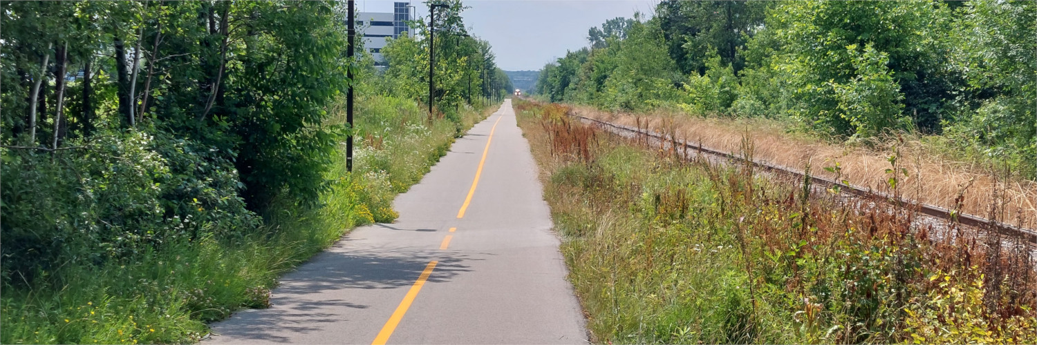
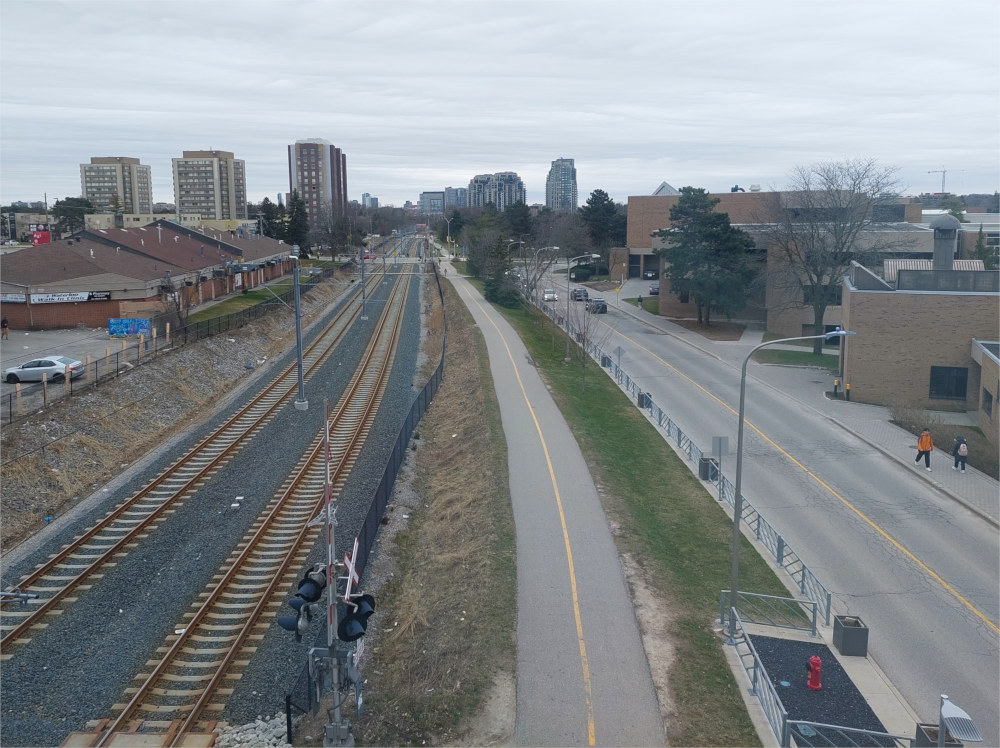
Instead of biking along the streets, there are dedicated bike trails, which are often routed through parks or less car-heavy areas. Most of these trails are separated not by type of traffic (biking vs walking), but by traffic direction, which makes them look like scaled-down versions of ordinary roads.
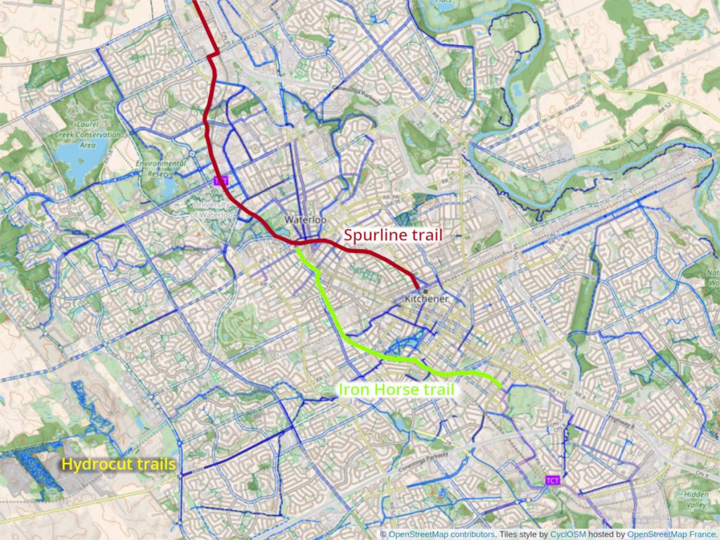
Two of them I use particularly frequently, they are marked in the map above: The “Iron Horse Trail” leads from central Waterloo to the southern part of Kitchener, and the “Spurline trail” goes from the train station in Kitchener to the Farmer’s market at the northern end of Waterloo. Both trails run along historic or active railway tracks, hence the names.

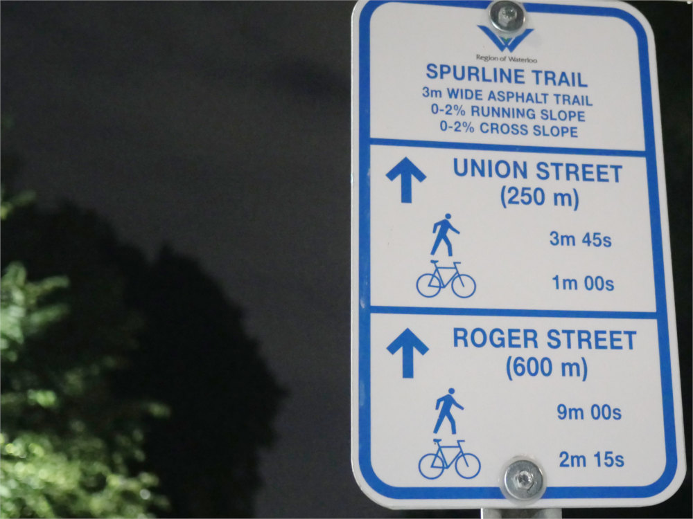
The Spurline trail follows the ION light rail from downtown Waterloo to the University campus, which makes it a major commuting route for students, and a backbone for cyclists and hikers who are visiting Waterloo park. The Iron Horse trail is useful for getting from Waterloo to Kitchener or beyond. These trails are typically cleared of snow in the winter just like other roads. Signs along the way give sometimes remarkably precise information about travel times and technical properties of the trail.
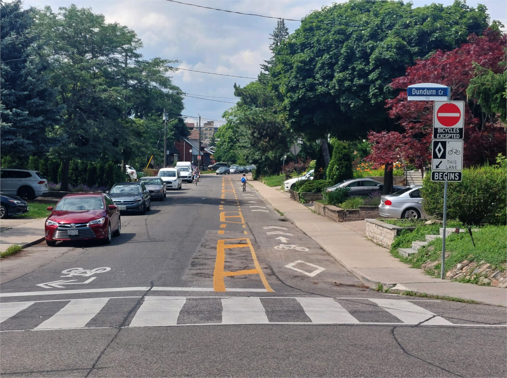
All in all, bike trails in Waterloo provide a very convenient, safe, and efficient way of biking as long as the destination is located at one of them. If not, there is still a chance of having a dedicated bike lane on a car road. These type of painted bike lanes on roads are also popular in certain parts of Toronto. Sometimes, bikes are allowed to go in the opposite direction of cars in one way lanes.
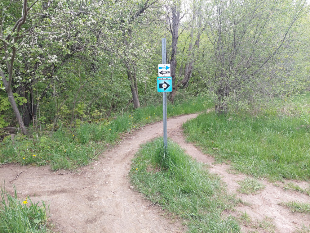
If you bike in Waterloo, another thing you will sooner or later encounter are the Hydrocut Trails. They are a sophisticated system of mountain bike trails in the south west of Waterloo. In principle, they are open and free to use, but they might be declared closed e.g. due to bad weather. I went there twice, but for lack of a mountain bike I couldn’t make full use of them. Nevertheless, it is impressive just how many mountain bike trails there are, how cleverly they are routed and how much effort is being put into keeping them in excellent shape. If you have a mountain bike, you should pay them a visit and perhaps even get involved with the community that supports them.